|
|
 |


|
|
|
|
|
|
|
|
|
|
|
Otaku-sempai
Elvenhome

Oct 21 2019, 5:13am
Post #1 of 7
(2450 views)
Shortcut
|
|
The Lands of East Rhovanion (completely speculative)
|
Can't Post
|
|
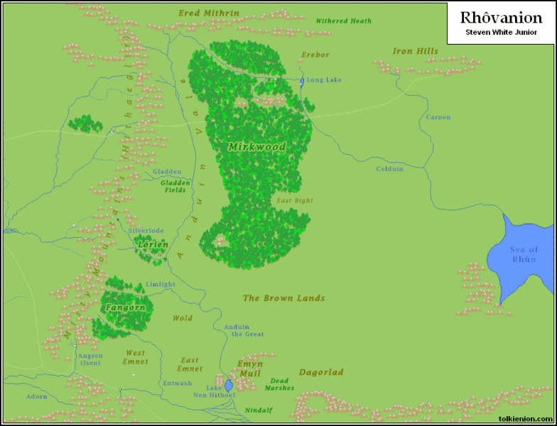
I've been working on one of my home-brewed (i.e. unofficial) supplements for The One Ring Roleplaying Game, specifically "A TOR Guide to East Rhovanion". The new map of Middle-earth for TOR 2nd Ed. is making me rethink my approach for the region of East Rhovanion. Specifically, the Brown Lands seem more expansive than I previously thought; expansive enough to define the southern border of that region. I now have East Rhovanion divided up thusly:
- The Northemnet: Archaic name for the Nether Marches of the lands of Dale.
- The Southemnet: The central region of East Rhovanion, bordered on the east by Dorwinion.
- The Northfolde: Borders the Heart of Mirkwood above the East Bight.
- The Southfolde: Borders Southern Mirkwood from the East Bight to the Brown Lands.
- Emyn Rhovanion: The Hills of Rhovanion, on the west coast of the Sea of Rh�n south of Dorwinion. Dwarves (of an eastern folk) inhabit these hills, as do Trolls.
- The South-march: A band that stretches from the Southfolde to Emyn Rhovanion, bordering the Brown Lands.
Cubicle 7's new Map of Middle Earth.
And here is a different map that I can reproduce here:
"Change is inevitable. Growth is optional." - DRWolf (after John C. Maxwell)
(This post was edited by Otaku-sempai on Oct 21 2019, 5:26am)
|
|
|
Otaku-sempai
Elvenhome
Oct 21 2019, 6:03am
Post #2 of 7
(2427 views)
Shortcut
|
1. The Nether Marches is the land that lies between the Running River (Celduin), below the nearest point where it approaches Mirkwood, and the Redwater River (Carnen). The name was coined for The One Ring Roleplaying Game. To the north lie the Upper Marches; and beyond that, the Waste.
2. The Heart of Mirkwood lies mostly between the Old Forest Road and the East Bight where the forest narrows.
"Change is inevitable. Growth is optional." - DRWolf (after John C. Maxwell)
(This post was edited by Otaku-sempai on Oct 21 2019, 6:08am)
|
|
|
grammaboodawg
Elvenhome

Oct 21 2019, 12:03pm
Post #3 of 7
(2394 views)
Shortcut
|
I don't partake roleplaying games, but just looking over your borders and the layout of the map is fascinating. The Brown Lands are a fairly light reference in the story, so I tend to speed past them and carry on with the journey. This map and your points have me more curious about them. Thank You!
We have been there and back again.
TIME Google Calendar
|
|
|
Otaku-sempai
Elvenhome
Oct 21 2019, 1:41pm
Post #4 of 7
(2386 views)
Shortcut
|
Thanks! Based on earlier maps of Middle-earth, I would otherwise have placed the South-mark between the Hills of Rhovanion and the Ash Mountains of Mordor, with the Brown Lands to the west.
I named Emyn Rhovanion myself and also made the decision to place a dwarven settlement there, founded after the end of the War of the Dwarves and Orcs. In addition to Trolls, I will likely also place Ogres in the hills (creatures only mentioned in The Hobbit, but introduced in The One Ring Roleplaying Game. I may even introduce a variant with spell-like abilities, inspired by the ogre mage of Dungeons & Dragons, itself based on the oni of eastern legend.

"Change is inevitable. Growth is optional." - DRWolf (after John C. Maxwell)
(This post was edited by Otaku-sempai on Oct 21 2019, 1:56pm)
|
|
|
Otaku-sempai
Elvenhome
Oct 30 2019, 5:13pm
Post #5 of 7
(2169 views)
Shortcut
|
Smaller map of Middle-earth from Cubicle 7 (click for a larger image):

#FidelityToTolkien
(This post was edited by Otaku-sempai on Oct 30 2019, 5:14pm)
|
|
|
Otaku-sempai
Elvenhome
Oct 31 2019, 1:08pm
Post #7 of 7
(2095 views)
Shortcut
|
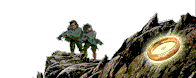
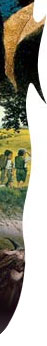
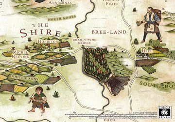
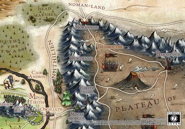
Unfortunately, I know of no plans to release the map as a poster. Cubicle 7's licensing agreement does not seem to allow it (unless things have changed since the last I knew about it). The announcement did include some close-up images of several regions.
The Shire (Buckland seems to have been squeezed out; but I've seen some indications that this has already been fixed):
Northern Mirkwood:

North Ithilien and Mount Doom:
#FidelityToTolkien
|
|
|
|
|